Beach articles today 2 / 3
Unlimited with Premium →
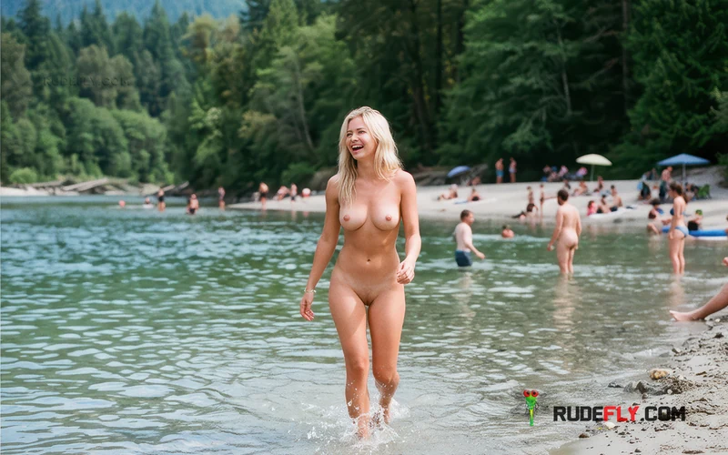
Norrish Creek
Reported naturist beach
📍 British Columbia, Canada
Norrish Creek is listed as a reported naturist-use creek area in Fraser Valley, BC. See planning notes, etiquette and visit expectations before visiting.
≋Beach details
CountryCanada
RegionBritish Columbia
Naturism statusReported naturist beach
WaterbodyRiver
Place typeRiver beach
Best season07-08
01020304
05060708
09101112
📍 Map & location
DISCOVER MORE
Explore similar beaches
Location
Naturism
Beach characteristics
Overview
Norrish Creek in British Columbia is listed in this directory as a reported naturist-use location in the Fraser Valley Regional District, Canada. Travellers searching for Norrish Creek naturist swimming should treat it as an unverified creek-side spot rather than an established designated area. The record places it near Area G, described as Deroche, Dewdney and Sumas Mountain, at the supplied coordinates, with a river-type water setting implied by the creek name. Information about access, facilities and local conditions is very limited. Anyone considering a visit should research current local access and land rules carefully, plan for an undeveloped outing, and expect a quiet, self-sufficient experience with no confirmed services.
Visiting the beach
Planning for Norrish Creek needs to start from the limited facts available: a directory-listed, reported naturist-use creek location in the Fraser Valley Regional District of British Columbia, near Area G around Deroche, Dewdney and Sumas Mountain, in Canada. The supplied coordinates are the only locational reference, and the creek name indicates a river-type water setting. Summer months of July through August are generally the most practical season to consider for an outdoor creek visit in this region, within the America/Vancouver time zone. Because access routes, parking, trails, ground conditions, water access points and facilities are not confirmed, treat every logistical detail as unverified and subject to change. Before travelling, check current maps, land ownership, road status and any posted notices for the exact coordinate area, and confirm whether public access is permitted on the intended date. Have an alternative plan in case the location is inaccessible, unsuitable, closed, privately managed or inappropriate for naturist use on the day. Allow extra time for cautious navigation, limited signage and possible detours, and avoid relying on a single route or parking assumption. Travel as for an undeveloped natural area: carry navigation, communication, drinking water, food, sun protection, insect protection, first-aid supplies and leave-no-trace equipment. Wear sturdy footwear for uneven banks and bring both swim and warm, dry clothing for changing weather and cool water. Do not rely on toilets, showers, drinking water, lifeguards, shops or mobile coverage. Visit in daylight, preferably with a companion, tell someone your plans and expected return, assess creek banks and water carefully from shore first, and avoid entering water when flow, depth, clarity or footing are uncertain. Keep the visit low-impact, take all rubbish away, respect other visitors and nearby land, and leave promptly if conditions, other visitors or signage make nude use inappropriate.
Naturist rules
At a listed but unverified place such as Norrish Creek, conservative naturist conduct matters from arrival to departure. Remain clothed until you have confirmed privacy, suitability and that no objections are likely from other visitors or nearby land users. Keep nudity discreet and limited to a settled, out-of-sight position rather than trails, roads, viewpoints or shared access points. Bring a towel to sit on, keep swimwear accessible, and cover up promptly when others approach or pass. Avoid staring, photography, loud behaviour, lingering near access routes, or sexual activity of any kind. Respect other creek users, neighbouring land and wildlife by keeping noise low and giving people generous space. Take all litter with you, avoid moving rocks or damaging vegetation, and leave banks undisturbed. If the setting feels exposed or busy, remain clothed or leave without dispute.
Visitor overview
Norrish Creek should be understood as a directory-listed creek location associated with reported naturist use, not as a confirmed naturist beach, resort or designated site. The known context is Fraser Valley Regional District, British Columbia, near Area G, with a river-type creek setting and summer as the most plausible visiting season. Practical expectations should remain cautious: an undeveloped natural environment with no confirmed services, supervision, maintained access or established visitor pattern. Conditions on the day may differ from any description, and suitability for discreet nude use cannot be assumed in advance. Travellers should treat information as incomplete and verify access, land status and local acceptance before considering any visit. It will suit only self-sufficient travellers comfortable with careful research, cautious navigation, flexible plans and consistently discreet conduct.
Quick answers
Frequently asked questions
Where is Norrish Creek located?
The directory record places Norrish Creek in the Fraser Valley Regional District of British Columbia, Canada, near Area G around Deroche, Dewdney and Sumas Mountain. Use the supplied coordinates only as a starting reference for planning, and verify them carefully with current maps, road information and land status before travelling.
Is Norrish Creek an official naturist beach?
No. It is listed only as a directory claim associated with reported naturist use. It should not be treated as an official, designated or legally protected naturist beach. Conditions, access and appropriateness for nude use may vary considerably and need careful, respectful judgment on site.
What kind of water setting is Norrish Creek?
The name and available record indicate a creek, classified here as a river-type water setting. It is not described as a coastal beach, lake or constructed pool. Banks, depth, flow, water quality and entry points are unconfirmed, so assess conditions carefully from shore and avoid uncertain water.
When is the most practical time to consider visiting?
July through August is estimated as the most practical period for an outdoor creek visit in this part of British Columbia, within the America/Vancouver time zone. Weather and water conditions still vary by year and day, so check short-term forecasts closely and be ready to postpone or change plans.
What should I bring to Norrish Creek?
Plan for an undeveloped outing with no confirmed facilities or services. Bring navigation, food, water, first aid, sturdy footwear, sun and insect protection, swimwear and warm, dry clothing, plus leave-no-trace supplies. Do not expect toilets, showers, shops, lifeguards, maintained trails or reliable mobile coverage.
Community
What visitors say
RUDEFLY SUNSEEKERS
Who’s into this beach?
Meet Sunseekers connected with this beach.
Be the first one to comment!
No comments yet. Be the first!
Send
Keep exploring